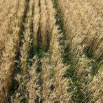
Snow depth on the Prairies, an important number for overwintering wheat crops, has decreased by four centimetres from 1948 to 2012.

Payoffs and pressures for cereals in a changing Prairie climate

Warmer, wetter, longer growing seasons carry risks as well as rewards

Cereal crops in Western Canada will be influenced by climate change in the coming years — but the impact will depend on both the crop and the primary area of Western Canada where it’s grown. Barley and oats are grown primarily in the cooler regions of the Prairies and will benefit from a longer growing […] Read more

canola in manitoba

Farmer interest growing in plant biostimulants

Companies hope to fill an existing 'knowledge gap' about the purpose of these products

Glacier FarmMedia — At 2 p.m. on July 17, Ryan Bonnett and many other people at the Ag In Motion farm show near Langham were seeking a place in the shade. The temperature was around 30 C and the word “hot” came up in most conversations at the show. The afternoon temperature was also on […] Read more


This is one of the weather stations Shannon Winny has on the family farm in Saskatchewan. The round black device at the top is the ultrasonic wind speed sensor. The station, powered by a small solar panel, can also collect data on rainfall, temperature, dew point, humidity, solar radiation and leaf wetness. The cables near the bottom are part of an add-on feature for soil moisture sensing. Basic models start around $1,100. | Photo: Courtesy of Shannon Winny


On-farm weather stations help guide management decisions

The return on investment can come from improved efficiency, helping growers get the most out of a crop under variable growing conditions

An on-farm weather station doesn’t make the crop grow better, but farmers and agrologists using the technology say real-time information about precipitation, wind, temperature and soil moisture reserves can help guide decisions about if or when to apply crop inputs — and provide a good indication of what yield they might expect. Field scouting is […] Read more

File photo of autumn colours around Lake Diefenbaker in Saskatchewan Landing Provincial Park. (Nancy Anderson/iStock/Getty Images)

Prairie forecast: Cooler, but still warmer than average

Forecast issued Sept. 25, covering Sept. 25 to Oct. 2, 2024

Despite a fairly unsettled pattern over the last forecast period, the weather models did a pretty good job of the forecast. For this forecast period, things should settle down a bit with a ridge of high pressure starting off our forecast. That doesn't mean that we won’t see any areas of low pressure, but unsurprisingly, the weather pattern is slowly shifting towards more of a fall pattern. That means quicker moving systems.


(Photo courtesy Canada Beef Inc.)

Prairie forecast: Weather pattern has undergone a shift

This forecast period starts with one of the northwestern U.S. lows slowly lifting northwards. The unsettled weather that started the week across parts of Saskatchewan and much of southern Manitoba looks to continue. It appears the low will only move out late Friday or early Saturday. Even parts of southern Alberta my see some rainfall from this low on Wednesday.

(Photo courtesy Canada Beef Inc.)

Prairie forecast: Cooler and wetter in the west, dry and warm in the east

Forecast issued Sept. 11, covering Sept. 11 to 18, 2024

Our weather pattern looks to be on the brink of a shift as a trough of low pressure begins to develop along the West  Coast. For those of you in Alberta, this will mean cooler and wetter conditions. In Manitoba, it looks like summer will continue for at least one more week. If you are in Saskatchewan, well, you will be stuck in the middle of these two features.


Photo: Thinkstock

Prairie forecast: Warm but unsettled weather

Forecast issued Aug. 21, covering Aug. 21 to 28, 2024

Last week's forecast got off to a rough start. The area of low pressure that pushed through the eastern Prairies ended up as a large upper level low. Because those are slow to move out, they can affect systems trying to move east by backing them up or forcing them to take a different path. So, while the overall pressure pattern across the Prairies was still slack as forecasted, the details got all messed up.


LRPhotographies/iStock/Getty Images

Prairie forecast: Weak systems make for tricky forecast

Forecast issued Aug. 14, covering Aug. 14 to 21, 2024

The slack or weak pattern looks to continue into much of next week, which makes it difficult to pinpoint which areas could see showers or thunderstorms, and on which days. Best chances for precipitation look to be over the eastern Prairies. This type of pattern also makes it difficult to predict where forest fire smoke will be.

Photo: IanChrisGraham/iStock/Getty Images

Prairie forecast: Temperatures to warm up

Forecast issued Aug. 7, covering Aug. 7 to 14, 2024

For this forecast period, it's looking like the forecasted strong area of high pressure is going to dominate the weather across the Prairies. This should bring plenty of sunshine and warming temperatures. Overnight lows look to be seasonable, so at this point it doesn't look like we'll see heat warnings—but as usual you just never know.