Over the years, I have found readers like to hear about “how it all happened.” Sure, the results and how the results can direct crop practices is important.
For soil salinity, our results have been communicated broadly for decades and practices have changed, but, in this piece, I will let you know how it all happened!
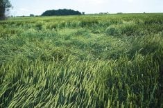
In your face: The late 1970s and soil salinity
Read Also
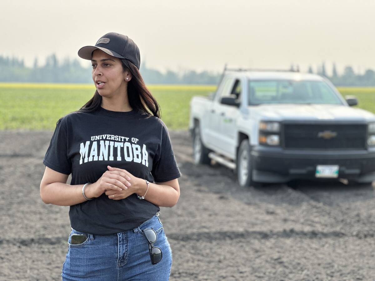
Corn research looks for Manitoba-based weed control
Manitoba corn growers rely on U.S. or Ontario weed control recommendations. University of Manitoba researchers are developing weed control advice with Manitoba field conditions in mind.
The early 1970s were very wet including the huge snow dump in the winter of 1973-74. That would have raised water tables and was the “setup” for a big increase in soil salinity.
As the dry years of the late 1970s and early ’80s arrived, white salts were “in your face” just by driving down the highway.
Some thought soil salinity was increasing by 10 per cent each year and we would soon have no land to farm. The government of the day was developing a program to have more research done on actual farm fields and wanted to set up committees to oversee each project.
I was never a fan of committees, so it took a while to negotiate but we were eventually supplied enough funds to buy equipment, hire staff and get started.
We assembled the “salt patrol” with very good staff who made it all possible. In alphabetical order they are Paul Bullock, Terry Hogg, Larry Luba and Graham Phipps. After our project, they all went on to successful careers in agronomy or hydrogeology.
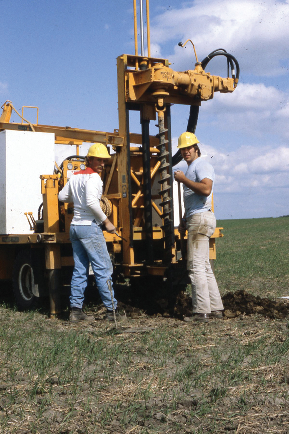
The first decision was what kind of drill to buy. I had worked with folks in the Outlook irrigation area who had a Sterling drill that could take foot samples to 20 feet in jig time. But, what if the answer was at 21 feet?
We decided on a Mobile drill mounted on a one-ton truck with augers that were five inches in diameter and five-foot lengths, and enough of them to drill to 45 feet.
Our first year of operation was 1982. At that time, Sask Ag still had 42 rural extension agents (agricultural representatives or ag reps) who worked with local farmers to solve local problems.
We had their full co-operation in suggesting sites and farmers to approach about investigating salinity on their farms. The local knowledge was very valuable and appreciated.

Field lab
For our field investigations, the idea of sending soil samples off to a lab was out of the question. An on-site lab was essential, and Hogg made it all happen in spades. We started out using whatever space was available on the farm we were at.
We soon graduated to a large lab trailer. As soon as the first hole was sampled, Hogg was busy doing the lab data we needed. The trailer also served as a place for maps, etc., and meetings with farmers.

Our first ‘on-farm’ investigation
Step one for any investigation was to do “the homework.” We checked soil and topographic maps, air photos and especially the old municipal assessment maps, which clearly mapped the soil salinity on each quarter section at the time the assessment was made.
The first site was near Saskatoon at Prudhomme on rolling land with calcareous (limy) eroded knolls. Those knolls were being interpreted as saline. However, there was some salinity on a flat quarter.
Our first item of business on the farm was to meet with the farmer and have him or her explain the problem to us and we provided information from our “homework.”
At the Prudhomme site, the farmer thought perhaps the problem could be coming from nearby salty Buffer Lake. A quick look at the topographic map showed Buffer Lake to be at an elevation of 1650 feet above sea level while the farm soil salinity was at 1825 feet. Next question please!
The first fieldwork was to use an EM38 to establish the geography of the problem. The EM38 was essential to any fieldwork, not just salinity.
Over the course of our soil salinity work, I walked many miles with me on one side and a farmer on the other watching the needle move and listening to my interpretation of what the EM38 was telling us.
At the Prudhomme site, we used the Mobile drill to trace gravel from a nearby abandoned gravel pit to a road ditch that led to the problem.
When I read our first report, it makes me realize how little we really knew at that time. The learning continued with each new site. After about three years we really did understand the problem and could communicate that to farmers and extension folks.

Site No. 2: Big learning
Our second site was in the deep southwest, northwest of Shaunavon on the Bruce Poppy farm. Several holes were drilled to 20 feet — some were salty, some not, with no apparent reason.
We then selected an area in the grass that was obviously very salty and “let it all hang out.” We used all of the auger lengths we had and ended up with a 43-foot hole. It was glacial till and grey in colour with a bit of seepage in places but no hint of what was causing the problem.
We were confused and clearly needed help. At that stage, I hired geologist Earl Christiansen as a private consultant. Christiansen said, “You have the wrong equipment and are doing it all wrong.”
Soil science may be top down, but geology is a bottom-up affair. You should be using a driller with hydraulic rotary equipment and drill to a defined base of exploration, which in this case was the Shaunavon aquifer.
I had no idea what a hydraulic rotary drill was or how to hire one. Christiansen hired Campbell Brothers drilling from Swift Current and proceeded to drill at our site. Lo and behold, the Shaunavon aquifer came in at 53 feet with the head just below the soil surface. Problem solved. We now knew why the salinity was there and could recommend next steps with confidence.
The next step was to leave the grass in place and carry on farming the rest of the land. That was done and the grass and our piezometers are still there.
This big breakthrough gave us confidence to get serious about geology and I spent much time in the library digging out geology and groundwater studies from early years.
While with the Saskatchewan Research Council, Christiansen and Bill Meneley did a lot of good work but by that time they had gone private. We hired them as private consultants to teach us the geology and groundwater.

Private consultants
Hiring private consultants was not welcomed by all of my colleagues. Why not use public geologists was the argument. My retort was, “Because when I ask Earl and Bill a question, I get an answer.”
We carried on with the rest of that field season and in late fall I was active with public speaking opportunities to spread the word.
The Deputy Minister of Saskatchewan Agriculture was at one of those events. He contacted me to come to Regina to meet with the government caucus to let them know what we were up to — maybe they could spring for more money to advance the work?
So, there I was in a small meeting room in the legislature building waiting for the day’s session to end. When it ended, the MLAs came tumbling into the small room and pizza was available for all. I had 10 minutes to spill my guts, so I did just that.
When I finished, the only question was, “If we give you more money can you do it faster?” The upshot was the Minister of Agriculture came to the office of the University of Saskatchewan president and handed me a cheque for $100,000. That was a big boost for the next year.
Once we knew the actual cause of most of the soil salinity, we were able to cover much ground and started to do the geology and aquifers of entire areas.
The ‘dog and pony’ shows
We held many town hall meetings to explain the soil salinity problem for an entire area. We wallpapered the hall with the geologic cross-sections that Christiansen constructed and used tables for air photos and topographic maps.
We requested farmers bring a water sample from their wells and many did. A lab was set up in the kitchen or bar to analyze the samples for total salt, hardness and nitrate. We even had an early Mac computer and printer so farmers could take home a printed copy of their water analysis.
I would lecture for about an hour with a question period after that. By that time, the lab manager (Terry Hogg) would shout out the soil electrical conductivity and hardness from some of the samples.
From that data, I could tell the crowd where that sample came from — the geology and geography of the aquifer, for example.
The ag rep from Wynyard had farmers come to his office years later wondering how we managed to do that. It was fun.
The best example was from a meeting at Duval on the east side of Last Mountain Lake. One sample had very low salt content. My comment was, “That sample did not come out of the ground in this area unless it is from a shallow well very high up on Last Mountain.”
Turned out the sample was brought in by a town employee from Watrous where the town supply is from a surface aquifer with low salt content.
More money, please
By that time, we had a big head of steam and needed serious money to carry on and cover more areas. NSERC (National Sciences and Engineering Research Council of Canada) established a strategic grant to provide $1 million, which was serious coin in those days.
To qualify, the project must be making significant gains on a problem that affected a current societal issue. The grant would allow the project to ramp up and quickly provide practical answers for that problem. Our soil salinity project fit like a glove, and I thought was sure to be funded.
I spent many hours preparing the application to make sure it explained what we would do and how it mattered. To my great surprise and anger, we were turned down — not because of the project or the application but because I did not publish enough in peer-reviewed journals. I know that to be true because a member of the evaluating committee told me so.
I did publish one major paper in the Canadian Journal of Soil Science that PAgs or CCAs can check out in Volume 65, pages 749-768, 1985, by Henry, Bullock, Hogg and Luba.
The paper covered 16 sites from all over Saskatchewan and included fold-out pages to accommodate geologic cross-sections. It could have easily been split up into about 10 papers, but I did not subscribe to the notion of “publish or perish.” I was more interested in getting the ideas to the farm gate where they could be put to use to enhance profits on farms.
ERDA to the rescue
At the same time, the feds had a funding program under ERDA (Economic and Rural Development Act), which provided us with $1 million, and we were good to go.
The award of that $1 million had wide press coverage, so most farmers knew about it. Not long after the announcement, I was driving down a back road near Assiniboia and I noticed a farmer get out of his tractor and start to walk. I stopped and asked if I could give him a lift. He accepted and asked what I was doing in the area. When I told him we were working on soil salinity he said, “I hear that the government just gave $1 million to some university professor to study the problem.”
When I told him that was me, he was flabbergasted. He expected the university professor would be sitting in his comfortable office while workers went to the field to do the work. I am sure there was some coffee shop talk after that brief ride.
The final hurrah
Our final hurrah was to set up a leaching only experiment to prove to ourselves and others that we understood the soil salinity problem. It had been known for decades that the only solution was tile drainage plus leaching.
In our climate, the leaching part of it involved irrigation with good quality water and some suitable place to dump the salts leached from the soil.
At the university’s Goodale Farm near Saskatoon, we developed a flowing well from a glacial aquifer with a depth of 130 feet and head of 10 feet above the soil surface.
We used a drip irrigation system to apply a known quantity of the aquifer water to replicated small plots. A city type water meter was used to accurately measure the amount of water applied. Phipps set it all up, so it functioned perfectly.
Readers with Henry’s Handbook of Soil and Water can check out pages 94-95 to see the whole story. Others can check out this link for a complete report of yield data, etc., https://harvest.usask.ca/bitstream/handle/10388/11415/J.L.%20Henry%2c%201989.pdf?sequence=1&isAllowed=y.
To make a long story short, it worked like a charm. In super dry 1988, the dryland yield was zero barley but the plots irrigated with the salty groundwater (total minerals of about 3,000 parts per million) yielded 50 bushels per acre.
In a better year we grew 100-plus bushels per acre of barley with irrigation but no fertilizer. The soil was loaded with nutrients.
I took the College of Agriculture research dean out for a look and he was very impressed. He urged me to gear it up to a larger field scale. My response was, “No. I am shutting the whole project down.” We were finding the same thing over and over again. It was no longer a knowledge problem.
The water table at the site was a few feet below ground and we were adding 700 pounds of salt with each inch of irrigation. The only way the project would succeed long term was to install tile drainage and have somewhere to dump the salty water. We were already at the local low spot so that was not an option.
It would have been possible to carry on for several years and funding would have come easy. However, I thought the taxpaying public deserved better treatment than that.
And so, the big project was wound down. A complete final report was written with an accounting of how all of the $2 million was spent over approximately 10 years. There was $100,000 left in the kitty when we shut down and that went back to the provincial government, which had given us $100,000 when we were struggling for money.
And so, my friends, that is how it all happened. It was great fun to put some light on a problem that was not well understood. The best part of the gig was that we had complete freedom to do it our way — no committee needed!