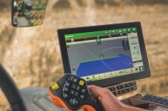

In spring many producers lost GPS signals and were forced to go old-school and actually use the steering wheel — or shut down until service was restored. That interruption was caused by intense solar flare activity, creating outages across most of North America.
It may not be the only GPS interruption producers can expect through this growing season.
The U.S. National Oceanographic and Atmospheric Administration (NOAA), which tracks and forecasts the kind of solar activity that disrupts radio and communication signals, sees more trouble ahead. Solar activity follows a cycle, peaking every 11 years. The current cycle, number 25, is expected to be unusually intense.
Read Also

Mahindra moving forward with new tractors, post-split
Despite the dissolution of a key joint venture, farm tractor manufacturer Mahindra Ag says a new product lineup will be rolling out over 2026 and 2027.
According to NOAA’s Space Weather Prediction Center, “a revised prediction concludes that solar activity during Solar Cycle 25 will increase more quickly and peak at a higher level than that predicted by an expert panel in December 2019. The updated prediction now calls for Solar Cycle 25 to peak between January and October of 2024.”
Why that matters
“We have the ionosphere layer in space which is naturally charged, but usually it’s like flat, evenly distributed,” Trimble’s strategic marketing manager Maximillion Hiltmair says. “You can think about it like an ocean. When it’s quiet, it’s evenly distributed. But when you have these explosions from the sun, which causes these massive eruptions, this layer varies. The density gets higher. You have spots with high density and spots with low density.”
In the last outage, the ionospheric density increased over North America, and acted as a barrier to communication signals. All satellite signals that had to pass through this region of the ionosphere were disrupted.
“This particular storm was, I think, the strongest in 20 years,” says HIltmair. “It’s a very rare event and it was very big. It was very, very intense.”
Currently, there are four different constellations of global satellite navigation systems (GNSS): GPS, Glonass, Galileo and the Chinese BeiDou.
“The older receivers only support two of the constellations, which is GPS and Glonass,” Hiltmair says. “Also they’re only able to handle two frequencies. When we started, this was great for the time being. But now with recent advancements of newer constellations, there’s much more advancement out in space. And they’re using multiple frequencies now, three at least. So you have much more redundancy.

“This is something we at Trimble see has significant performance impacts during these (solar) events. It helps your receiver to better perform during times of these ionospheric storms. If you have an old constellation receiver and an old RTK base with just GPS and Glonass, you’re losing half or less than half the potential of the receiver. You need to make sure you get corrections for all of these frequencies to make the best positioning on the ground.”
Trimble notes that with only GPS and Glonass, a machine will get signals from 14 satellites on average. When capable of receiving signals from all constellations, that number increases to 27.
RTK or PPP?
There’s a difference between Trimble’s PPP (Precise Point Position) technology, used by its CenterPoint RTX offering, and RTK.
While RTK, which requires an additional base station and modem, offers precise, repeatable guidance to a high level of accuracy, it is vulnerable to atmospheric scintillation, that phenomenon that causes the Northern Lights from regional variations in intensity in the ionosphere.
Because Trimble’s RTX system uses PPP, it doesn’t require a local base station. Instead, it relies on a global network of base stations that collect multiple satellite signals and feed that data to a processing centre, which calculates local corrections. The finished data is sent up to a geostationary satellite, relaying it to a tractor receiver. It achieves one-inch accuracy that way.
“That’s the beauty of PPP: you don’t need a base station,” says Hiltmair. “You don’t need a modem on your tractor, so you can reduce the hardware costs and the complexity. We have a global tracking station network, where we get real-time data in our processing data centres, and we also have regional networks. This allows us to better adjust our data for the effects, which are happening. So we have better data to mitigate effects.”
But Hiltmair cautions no guidance system can be completely immune from the effects of an intense solar storm. If a signal can’t reach the tractor because it’s in an area of increased ionospheric activity, all systems will be affected.

PPP “is less susceptible to a short-term thing,” he explains. “I would say no guidance system will have no impact. What we usually hear is we can have a little more uptime than the RTK systems. But in a storm like this, if the tractor itself cannot make use of the signal it cannot do any positioning.”
But there is also one other feature Trimble’s RTX system offers to help maintain connectivity: the ability to receive guidance data at the tractor through the internet, via cellular service.
Says Hiltmair: “We just recently launched a new feature where the [farmer] can decide what’s currently best for him, if he wants to get the information via IP or L band. If there’s a blockage in the line of sight from the satellite, you can still get the correction via IP through a modem, smartphone or hotspot in the tractor.”
ALSO: Would GPS guidance be at risk in a war?
As the Ukrainian military continues to try and fend off Russia’s invasion forces, it’s brought into focus just how vulnerable the GNSS guidance system producers rely on would be in an expanded geopolitical conflict.
Much of the advanced guided weaponry developed by the U.S. and other friendly countries relies on satellite signals to direct units to their targets, in the same way farmers rely on it to keep a sprayer in the wheel tracks of its last pass across a field.
Russia has apparently been adapting to that guided weapons threat to its army by jamming satellite signals, reducing the effectiveness of Ukraine’s weapons.
According to a recent article in PC Magazine, Russia has developed electronic weaponry capable of degrading the signal from the Starlink internet service Ukraine uses for military communications. It also reports a Russian official told the state media that Starlink has been added to Russia’s “list of targets.”
CBC has reported airlines have had to cancel flights from Helsinki to the Baltic states because GPS signals have been jammed, interfering with air navigation. Other reports from aviation authorities around the Black Sea region report similar problems.
Not surprisingly, the finger of blame for those incidents is pointed directly at Russia.
In the most concerning development, BBC says Russia launched a satellite on May 17 that may be capable of destroying other satellites, such as those providing GPS guidance.
The article quotes Pentagon spokesman Brig. Gen. Pat Ryder as saying, “Russia launched a satellite into low Earth orbit we assess is likely a counter space weapon.”
It is reportedly on the same trajectory as a U.S. satellite.
The BBC article also cites a report last year from the Washington, D.C.-based Center for Strategic and International Studies as suggesting Russia is “developing a range of anti-satellite (ASAT) weapons, including a missile that was successfully tested against a defunct Soviet-era satellite in November 2021.”
As rhetoric from Russia becomes increasingly hostile toward NATO countries, the risk to global technology infrastructure is of growing concern.