Forecast issued March 18, covering March 18 to 25, 2026
Highlights
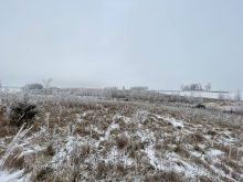
- Several chances for rain and snow across central and northern Alberta
- Warm air has spread across Saskatchewan and will reach Manitoba on Wednesday before temperatures begin to cool on Sunday
Overview
While spring appears to be gaining a foothold across the western Prairies, it continues to struggle across the eastern regions. This forecast period looks milder than the last, but weather models are still not showing a clear or sustained shift toward a more spring-like pattern.
Read Also

Prairie forecast: Arctic air dominates the forecast
For this forecast period, it appears we will need to wait a little longer for spring to arrive. Weather models continue to show a northwesterly flow across the region, but this time the dividing line between mild and cold air has shifted slightly farther south. As a result, near to below-average temperatures are expected across much of the Prairies.
We begin this period with a shallow but broad upper ridge building across the southern Prairies while Arctic high pressure remains in place over northern Canada. Between these two features, several areas of low pressure are expected to move in from Pacific and track eastward across the central and northern Prairies.
More weather coverage: Taking a look at the spring forecast
Current model guidance suggests the upper ridge will begin to break down over the weekend, which will allow Arctic high pressure to push southward. This will shift the primary storm track from the central and northern Prairies into the central and southern regions by late weekend or early next week.
As a result, after a relatively warm start, cooler temperatures are expected to return. Along with this cooling trend comes an increased chance of precipitation which will likely fall mainly as snow.
There are also early indications of a potentially significant storm system affecting the southern and central Prairies around next Wednesday. However, as is often the case at this range, details remain uncertain.
Alberta
This forecast period begins with a surge of warm air supported by a building upper ridge and a strong westerly flow off the Pacific. Southern regions should see more sun than cloud from Wednesday through Friday, with daytime highs reaching the mid-teens.
Farther north, weak disturbances moving over the ridge will bring a mix of sun and cloud and the chance of a few showers. Temperatures in these areas should remain mild, with daytime highs around 10°C.
By the weekend, the upper ridge is expected to break down. This will allow cooler air to push southward while also shifting the storm track into the province.
An area of low pressure is forecast to develop over central Alberta on Saturday, bringing snow to those regions before tracking into southern areas late Saturday into early Sunday. It will bring the potential for accumulating snow. Daytime highs will drop significantly, settling near the freezing mark.
Cooler and more unsettled conditions are expected to continue through Sunday and Monday. Looking ahead to Tuesday, models indicate a stronger area of low pressure pushing inland from the Pacific. This system is expected to bring snow to central and northern regions on Wednesday.
Southern areas may see rain or a rain-snow mix transitioning to snow as colder air moves in behind the system. This is a system worth monitoring closely.
Saskatchewan and Manitoba
Milder air that has already spread across Saskatchewan will begin moving into Manitoba on Wednesday. Expect more clouds than sun from Wednesday through Friday as a couple of weak disturbances track eastward in the westerly flow aloft. A few scattered showers or flurries are possible with these systems.
Temperatures will be warmest across southern Saskatchewan were more sunshine is expected, with daytime highs in the 10 to 12°C range. Across Manitoba, conditions will be slightly cooler, with highs of 5 to 8°C in western regions and 3 to 5°C farther east.
As the upper ridge weakens and shifts southward on Saturday, an area of low pressure is expected to track across the southern Prairies, bringing a quick shot of accumulating snow with amounts generally expected to be only a couple of centimetres.
More weather coverage: What climate change data gets wrong about the Prairies
Temperatures will cool, with daytime highs falling into the 0 to 3°C range. Skies should begin to clear on Sunday as Arctic high pressure builds into the region. This will bring sunny conditions into Monday and Tuesday along with cooler-than-average temperatures.
Attention then turns to a potential storm system developing over central Alberta and moving eastward on Wednesday. Current indications suggest this system could bring snow and blowing snow to central regions, while southern areas may see rain or a mix transitioning to snow.
The system is expected to move east by late Thursday, followed by a return to colder conditions as Arctic high pressure builds in late in the week. As always with systems this far out, details may change, but it will be one to watch.