Read Also
Prairie forecast: Warm start then cooler air to move back in
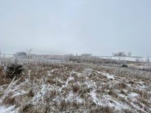
While spring appears to be gaining a foothold across the western Prairies, it continues to struggle across the eastern regions. This forecast period looks milder than the last, but weather models are still not showing a clear or sustained shift toward a more spring-like pattern.
With that said, here is the big picture of what the weather models are forecasting for the next seven days. At the surface, central North America will be under the influence of a large but disorganized area of low pressure. To our west and east are areas of weak high pressure. In the upper atmosphere, central Canada is expected to see a ridge of high pressure develop, while to our west and east weak troughs of cool low pressure are forecasted to develop. This seems a little backward as areas of low pressure at the surface are usually associated with a trough of low pressure in the upper atmosphere and visa-versa. For us, this means conditions will allow plenty of heat and humidity to try and build northward, which will help initial thunderstorms, but upper-atmosphere conditions overall do not favour storm development. This makes for a tougher than average forecast, at least when it comes to the details.
Alberta
It looks like the extreme heat will, at least initially, have trouble working its way into Alberta. Expect daytime highs to be in the low 20s with overnight lows falling into the low teens. It does not look like there will be any organized systems that will bring widespread showers or thundershowers during this period, but with the strong early-summer sunshine the occasionally thundershower can be ruled out. Hot temperatures look like they will begin to build in late in this forecast period.
Saskatchewan
Once again Saskatchewan is in the centre of all the main weather makers. There will be lots of low-level instability along with plenty of heat as the upper ridge helps to push temperatures upward. Expect daytime highs in the upper 20s to low 30s right through this whole forecast period with overnight lows only falling into the mid- to upper teens as humidity levels rise. Thundershowers and some thunderstorms could occur on any given day with Saturday and Tuesday seeing the best chances.
Manitoba
Manitoba is going to be centre of the heat during this forecast period. With the building upper ridge and the southerly flow on the eastern side of the broad low-pressure system across the central U.S., southern Manitoba can expect to see very warm temperatures. Daytime highs will be near 30 C on most days, with some days over the weekend or early next week possibly pushing into the mid-30s. There is a chance for a weak back door cold front to push through next Monday or Tuesday. If this happens, expect temperatures to be knocked down a little bit with highs only making it into the upper 20s. With all the heat and humidity, thundershowers will be widespread but limited in scope with Saturday and Monday seeing the best chances.
— Daniel Bezte is a teacher by profession with a B.A. (Hon.) in geography, specializing in climatology from the University of Winnipeg. He operates a computerized weather station near Birds Hill Park, Man. Contact him via email with your questions and comments.