
Thanks to readers for your book orders and kind notes of encouragement about my column. A recurring comment from readers is they appreciate the “thought provoking” ideas. Over many years of writing, there have been many articles that just provide facts and figures and specific recommendations for crop and soil conditions. However, some are designed to stretch thinking beyond current norms.
For many soil science folks, the world ends when their knuckles hit the ground with a four-foot hand auger. My interest in what goes on beyond normal soil profile depth began with my very first research project on nitrate-nitrogen (nitrate-N) leached to greater depths and, perhaps, contaminating wells.
Read Also
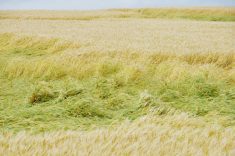
Lower canola seeding rates can pay off: study
Canola trials on the Prairies show lower seeding rates can still net plenty of positive results for farmers.
Nitrate-N leached below the root zone under various cropping practices
The depth objective was 20 feet but with the equipment we had at the time that depth was seldom achieved.
A special site comparison included the then-Federal Forestry Farm on the eastern edge of Saskatoon. There was a site between tree rows that had been continuously summerfallowed for 10 years. At that site, the nitrate-N to a depth of 16 feet was more than 1,200 pounds per acre (see Table 1). The crop/fallow rotation also had considerable deep nitrate. The native prairie had almost no nitrate and was so dry we could only get to eight feet.

Keeners who wish to read the entire project report can find it online. For that project, “deep” was 16 feet.
If any reader who wishes to learn more about nitrate in farm wells and infant death from blue baby syndrome, you can check out this link. This column has dealt with that topic many times over the years.
Soil salinity and ‘deep’ groundwater
This was the “biggie” that shattered accepted norms and put us on a very different trajectory — down, down deep. This file was where we really got into the “deep” category. In the late 1970s, soil salinity was running rampant. The early 1970s were very wet and raised water tables. The late 1970s dried out and evaporation did its thing and left white crusts in your face.
Southern Alberta was a hot spot for salinity and the prevailing wisdom was sidehill seep was the major mechanism. Water came in at the tops of hills, went down until it hit an “impermeable” layer and moved sideways until it came out as a sidehill seep. The solution was to plant the hilltops to alfalfa to suck up the excess water and the problem would be solved.
I had spent much time in the literature and came across a few references that talked about artesian discharge. I did not believe the sidehill seep model fit our situation and knew we needed a different approach.
After many months of negotiation, we were provided a grant to purchase equipment and vehicles to go to actual farms around the province and determine the cause of the soil salinity. The provincial ag reps (extension agents) suggested sites. The year was 1982.
A Sterling Drill was in common use, and we considered it. However, the maximum depth was 20 feet — but what if the answer was at 21 feet? We bought a Mobile Drill with enough auger to go in 43 feet. We also had a mobile lab to do analysis on the spot to further guide the work.
At our Shaunavon site, we drilled several 20-foot holes and took foot samples and analyzed them for salt, etc. Some were salty, some were clean, with no apparent reason. So, we picked a site in the middle of a very salty grass patch and hung it all out — 43 feet. Still no answer.
At that time, I consulted famous glacial geologist Earl Christiansen and hired him as a consultant. He said we were doing it all wrong. Soil science may be a “top-down” affair, but geology is a “bottom-up” business.
He hired a water well driller with a hydraulic rotary drill to drill right beside our 43-foot hole. Guess what? The answer was at 53 feet where the Shaunavon aquifer came in with enough pressure that the static water level was just inches below the soil surface.
The rest, as they say, is history. We went on to drill many flowing holes in salty areas at various depths up to a few hundred feet. Soil salinity on the University of Saskatchewan Goodale Farm is caused by a glacial aquifer 130 feet down with pressure to shoot water 15 feet above ground.
Water table and crop water use
All of the years we measured soil water use by crops, the water table was not part of the equation. We are a dry climate, so the water table is below rooting depth — or so we thought. It was not until many years after I was officially retired that we learned differently — and that was on my Dundurn farm.
In 2012, I did a crop tour in mid-July with my Dundurn neighbours. There had been little rain in previous weeks. In a flat part of my hilly ground the wheat crop was doing well. I expected the topsoil to be so dry that the soil probe would not go in. To my surprise, the soil probe went in like butter.
My conclusion was that a near-surface water table must be the reason. The neighbours were skeptical but after the tour was over, I installed, by hand, a 10-foot observation well. The water table was about 4.5 feet and capillary rise would keep the roots well supplied with water. The 20 inches of rain in 2010 was 10 inches more than the crop needed. We now know that would raise the water table by about eight feet.
The results of that and many other water table wells have been documented in Grainews several times.
For water table and crop water use “deep” is about 10 feet. If the water table stays below 10 feet at all times, it will not be a factor.
Reverse polarity to downward water flow and real deep comes into play
A few miles east of Gardiner Dam at Diefenbaker Lake, the soil survey in the 1970s did detailed work on a 40-acre parcel in a field of Weyburn loam soil — specifically, glacial till soils with low-relief hills and sloughs.
One large slough received special attention and detailed samples were taken to 20 feet. The soils were completely free of salts to 20 feet.
In this area, we had completed the deep geology as part of previous irrigation investigations. Beneath the site with highly leached sloughs there was a pre-glacial aquifer at a depth of approximately 300 feet. That aquifer drains to the South Saskatchewan River, so the head is very low. There are no other shallow glacial aquifers to interrupt the downward flow. Downward ever downward, slow by slow but every hour of every day for centuries.
In this case, deep was 300 feet.
An example of such deep drainage happens right on the University of Saskatchewan land. Just east of Preston Avenue and north of College Drive, there is a large shallow slough that fills up each spring and after each fast rain. Despite being clay soil that slough empties quickly — it flushes almost like a toilet.
Existing geology suggests there may be a deep (approximately 120 feet) pre-glacial aquifer that drains to the South Saskatchewan River west of the site.
It would be a great field lab for students if someone would drill at the site and confirm the geology and the downward gradient to the pre-glacial aquifer. Unfortunately, no one seems interested.
The bottom line: How deep is deep?
Deep for soils folk is the depth of the soil profile — approximately four feet. Soils is a top-down affair.
Deep for geologists depends on the nature of the investigation. It can extend hundreds of feet. Geology is a bottom-up affair.
The elixir that ties soil science to geology is water. Water flow that influences soils can be by upward movement or downward movement.
Have we stretched your brain just a little bit? Those who have Henry’s Handbook of Soil and Water might wish to read Chapter 12 to learn about the many examples that show how it all works.