In the mid to late 1970s soil salinity was the biggest issue on many Prairie farms. The hue and cry was that we would soon have little land left to farm. Some said salinity was increasing by 10 per cent per year but I never bought into that number.
From 1975 to 1980 we held town hall meetings on soil salinity in 74 Saskatchewan communities with average attendance of about 60. On February 1, 1978, 85 to 90 people attended a meeting at Wakaw, Sask. Salinity was a serious issue and folks were worried.
In the mid 1970s serious money was being made by Prairie grain growers and lots of grass was ploughed up to grow grain. At least some of that was salty and eventually went back to grass.
Read Also
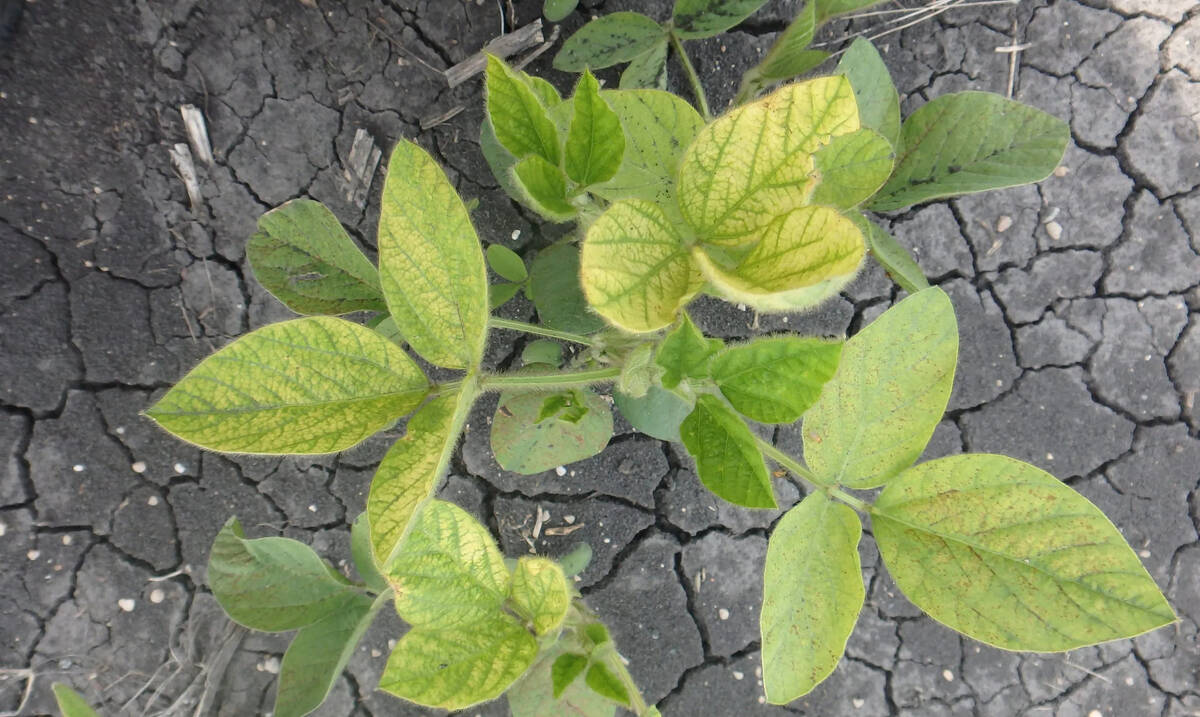
Selecting IDC-tolerant soybeans doesn’t reduce yield, Manitoba study confirms
University of Manitoba research shows soybean varieties selected for iron deficiency chlorosis (IDC) tolerance protect yield in affected areas without reducing performance elsewhere in the field.
Soil salinity was the topic of the technical session of the Saskatchewan Institute of Agrologists’ convention in Swift Current in May 1980. I was delighted to be part of the program and talk about types of soil salinity and to suggest what we had to do to get better answers. In that talk I used the term “horse pasture salinity.”
Horse pasture salinity (HPS)
Truth be known, the Saskatchewan Agriculture specialist Earl Johnson actually told me about HPS. It was that 40 acres that Grandfather had broken and found to be salty, so he planted it to grass and used it to pasture a few horses or the milk cows for the summer.
Fast forward a few years and the horses are no longer resident, so Grandson breaks that 40 acres up to farm. In grass it looked good, but farmed, it soon turns from black to white and grows little.
In our soil salinity on-farm programs of the 1980s and 1990s we found examples of HPS. On occasion the Sask Ag extension folks were advising farmers not to break pieces of ground but got kick back — if it grows grass it should grow wheat.
I remember one example very well. By that time we had EM38 instruments and could check salt levels right on the spot. The farmer and I took a walking tour of his known crop land area and he could see what it meant for various meter readings. Then we took a tour through the grass area intended for the plough. At the end of that tour he decided to leave the grass be.
1992: Native prairie near Saskatoon
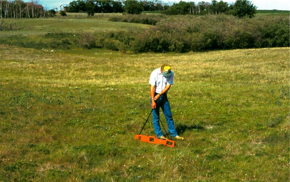
In September 1992 we were at an acreage near Saskatoon where the soil was Weyburn loam on hummocky topography of the knob and kettle variety. We were sampling sloughs and hilltops to study soil phosphorus in an original prairie grass. We used the EM38 to measure salt levels on the spot to interpret long-term water flow through various slope positions.
What we found surprised me a lot, even though by that time I thought I had a pretty good eyeball for salty ground.
The first photo (top of page) was taken at the bottom of a slough. The EM38 readings were: Vertical = 0 to 4 foot = 35: Horizontal = 0 to 2 foot = 24. Interpretation: this slough is flushed of almost all salts.
The second photo below shows the soil just a few steps away from Photo 1 and a bit higher elevation. The EM38 readings were: Vertical = 0 to 4 foot = 150: Horizontal= 0 to 2 foot = 105. Interpretation: this is a very salty piece of ground.

Without the EM38 I would never have recognized how very salty parts of that native grass were. It was a big learning experience for all of us at the site.
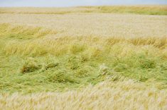
Grass covers up soil salinity. It does not reclaim it. The salts are still there. Come in with some big steel and bust it up and the salts will be in your face before you know it!
What to do now?
As in the late 1970s, we are again at a time when land is pricey and hard to acquire so some are looking at busting up that old pasture ground to make some real coin. Or some may have purchased “less expensive” pasture land to do the same.
If you wake up in the middle of the night in a cold sweat and an irresistible urge to break up some pasture proceed as follows:
1. Try to find someone old enough to know the history of the land. Not easy.
2. Contact your municipality to see if they have any real old assessment field data. Not likely.
3. Contact the National Air Photo Library and order up all available black and white air photos with stereo pairs. Expensive and time consuming and requires a lot of skills. Not likely many will do that. We did that in our soil salinity program in the 1980s and 90s and were able to find many examples where salinity was anything but new.
4. Find an agronomy consultant with an EM38 and hire them to make an EM38 map or walk the land with you to see what the salinity is like. That is the only feasible way to make sure you know what salt is in the ground. The new EM38 instruments are made specifically for simultaneous deep and shallow readings. They are great for mapping but not that convenient for field scouting.
The question is: Why is a piece of ground in grass in the first place?
For cow-calf operators grass is the way they make a living and a lot of good land is in grass for that reason.
But, when stubble jumpers with no cows leave a piece of ground in grass, it is not because they like grass. If it is not very hilly or stony or both, but a nice flat piece of stone-free ground, then it may well be salty.
Caveat emptor!