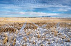
Not surprisingly for this time of the year, the last forecast didn’t play out exactly as expected, but overall, it was pretty darn close. The large area of high pressure that was forecasted to develop over the northern Prairies and slowly drop southward did just as forecast, but over the first few days the high was what is often called a “dirty high.”
This means it trapped moisture near the surface, which ended up creating more low clouds than were originally forecasted. Things did clear out fairly nice late last week and into the weekend, bringing what might be the last really warm spell of the year.
Read Also
Prairie forecast: Warm start then cooler air to move back in
While spring appears to be gaining a foothold across the western Prairies, it continues to struggle across the eastern regions. This forecast period looks milder than the last, but weather models are still not showing a clear or sustained shift toward a more spring-like pattern.
For this forecast period, it looks like we might undergo a shift in the weather as the weather models show an outbreak of cold arctic air sometime next week. The weather models have been all over the place with the details, so confidence is not high past the first three to four days of this forecast; stay tuned for updates.
There will be two areas of low pressure impacting our region to start this forecast period. The first is a weak area of low pressure sliding through southern Manitoba, bringing with it clouds along with some showers. The second low pressure system is a large one slowly coming ashore over north-central B.C. Ahead of this low a weak ridge of high pressure will develop over Alberta and Saskatchewan bringing a few more days of nice fall weather. Energy from this low will move eastward over the weekend, slowly breaking down the ridge. Northern and central regions may see some showers from this system as it tracks southeastward into Manitoba by Saturday.
Late in the weekend, another area of low pressure is forecasted to spin up over north-central Alberta and track northeastward. This low itself does not look it will create much weather, but it does look like it could open the door for a strong area of arctic high pressure to drop southeastward into the Prairies during the week of Nov. 23. As I pointed out, the weather models are all over the place with this, but it does look like there is the potential for the first real cold snap of the season, with maybe even the chance for a little snow.
Alberta
This forecast period will start off sunny to partly cloudy and seasonably warm as a ridge of high pressure tries to build ahead of the B.C. low. Expect daytime highs in the mid to upper teens on Wednesday and Thursday before cooling down to around the 10 C mark by Friday or Saturday. Central and northern regions may see the odd shower late on Thursday and into Friday as Pacific energy pushes through.
A second low is forecast to spin up late in the weekend, bringing the chance of showers or flurries to far northern regions. Behind this low cold arctic high pressure will begin to slump southward, bringing below-average temperatures to the northern half of the province starting Monday and to the southern half on Tuesday and Wednesday. Expect daytime highs by Wednesday to be below 0 C in the north and right around 0 C over southern regions.
Saskatchewan
This region should see clearing skies on Wednesday as a ridge of high pressure begins to build across the southern half of the province. Temperatures look to be mild, with daytime highs in the mid-teens and overnight lows falling into the 3 to 6 C range. Northern regions will be a little cooler. Northern and central regions will see cloud cover increase late on Thursday with some widely scattered showers on Friday as a weak low tracks through.
Behind this low, temperatures will cool down by a few degrees over the weekend under sunny to partly cloudy skies. By Monday (Oct. 23) the weather models show showers moving across the province as the Alberta low tracks by to the north and drags a cold front across the region. Not a lot of confidence in this part of the forecast, so watch for updates over the weekend. Things could get messy as arctic air plunges southward, interacting with an area of low pressure moving out of the northwestern U.S. This system has the potential to bring the first snow of the season on Wednesday along with much colder weather.
Manitoba
Wednesday looks to start off cloudy with maybe the odd leftover shower from a weak area of low pressure sliding through the southern half of the province. Skies should begin to clear by the afternoon as weak ridging tries to build into the region. This should bring sunny to partly cloudy skies on Thursday and Friday along with daytime highs in the low to mid-teens and overnight lows in the 2 to 5 C range.
Over the weekend an area of low pressure looks to bring cloudy skies on Saturday along with the odd shower before moving off to the east on Sunday allowing for a return of sunny to partly cloudy skies. Expect temperatures to cool down a few degrees with this system. To start the week of Oct. 23, the weather models show a weak cold front sliding through the province, bringing with it cloudy to partly cloudy skies along with the chance of a shower. Again, confidence in this part of the forecast is low, so watch for updates. By Wednesday much colder air is forecasted to move in from the northwest, bringing with it the chance of rain or wet snow.
— Daniel Bezte is a teacher by profession with a B.A. (Hon.) in geography, specializing in climatology from the University of Winnipeg. He operates a computerized weather station near Birds Hill Park, Man. Contact him via email with your questions and comments.