For the first time in a while, the last forecast period did not play out exactly as the weather models predicted, thanks mostly to a strong area of low pressure that moved westwards from the Atlantic into central Ontario last weekend and into the first half of this week.
While the low didn’t impact the weather directly across Alberta and Saskatchewan, it did help to break down, or at least, disrupt the building ridge of high pressure across the Prairies. Across Manitoba, while the low prevented this region from seeing any really warm temperatures, the ridge did remain strong enough to keep all but the eastern half of the province relatively cloud-free.
Read Also
Prairie forecast: Warm start then cooler air to move back in
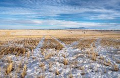
While spring appears to be gaining a foothold across the western Prairies, it continues to struggle across the eastern regions. This forecast period looks milder than the last, but weather models are still not showing a clear or sustained shift toward a more spring-like pattern.
For this forecast period, the central Ontario low will begin to weaken and drift back off to the east. This feature did create a pool of cold air across much of Ontario that looks to stick around for most of this week, which will indirectly affect the weather pattern across the eastern Prairies. Across the Prairies the weather models show a weak area of low pressure over far western Alberta on Wednesday and Thursday. This low is expected to drop southeastward into the U.S. by Friday, pushed southward by a large area of high pressure that is forecasted to build across the central and northern Prairies. This high looks to dominate our weather right through to the end of this forecast period.
The clockwise flow of air around the high, combined with the cool pocket of air over Ontario, will result in the warmest temperatures occurring over more northern regions to start, but as the high slowly builds and drops southward, southern regions should see above-seasonable temperatures move in by the weekend. Currently it looks like dry conditions with clear to partly cloudy skies and above-average temperatures will continue at least into the first half of next week.
Alberta
Western Alberta will see clouds and some showers to start off this forecast period as an area of low pressure edges into the province from the west. The building area of high pressure over the north-central Prairies will help to shunt this low to the southeast by late on Thursday or early on Friday. Clear skies look to prevail over the weekend and into the first half of next week as the area of high pressure establishes itself across the Prairies. Temperatures will be seasonably warm with daytime highs expected to be in the low to mid-teens through most of this forecast period. Overnight lows will be cool but still above average, with most regions seeing lows drop into the 2 to 5 C range.
Saskatchewan
Dry, sunny to partly cloudy skies, along with warm days and clear cool nights sums up the seven-day forecast for Saskatchewan. High pressure will develop across northern Saskatchewan/Manitoba on Wednesday, then slowly build and drop southward over the weekend and into the first half of next week. Expect temperatures to slowly rise into the low to mid-teens by the weekend with overnight lows falling on most nights into the 1 to 5 C range.
Manitoba
The forecast for Manitoba is much the same as for Saskatchewan. The northern Prairie high will keep skies clear to partly cloudy for pretty much this whole forecast period. As the high drops southward, expect daytime highs to warm into the low to mid-teens by the weekend and into the first half of next week with overnight lows start off in the -2 to +3 C range, then slowly warming into the 2 to 5 C range. There are no signs of any precipitation, but the weather models do show an area of low pressure tracking by to the south early next week. Currently all model runs show the strong high over the Prairies keeping the low well to our south.
— Daniel Bezte is a teacher by profession with a B.A. (Hon.) in geography, specializing in climatology from the University of Winnipeg. He operates a computerized weather station near Birds Hill Park, Man. Contact him via email with your questions and comments.